Tuesday 31 May 2016

DAY 45 - LE BOURG D'OISANS (REST DAY)

RANDOM REST-DAY RAMBLINGS

Today was another rest day and we spent the first part of it strolling around Le Bourg d'Oisans.  Lucy took us to the 'not to be missed' museum but it was closed so we unfortunately missed it.

Wandering around town
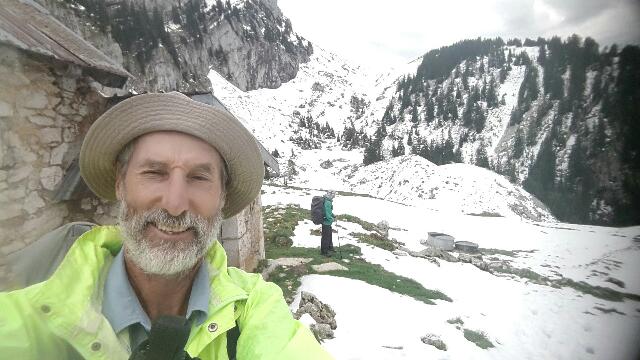
Russell as usual taking photos
Health: Russell's lanced blister is healing well, Kath has a slight calf strain, Lucy has a mildly sore throat - so pretty good!

Food: Still eating lots! Last night Russell and Kath had their usual 3 course meal while Lucy was content with just 2 courses.

Lucy with her crepe flambé 
A local speciality, blueberry and apricot tarts
Hiking with our delightful older daughter: Lucy noted the absence of Gummi Bears as a reward on her hikes with us now she is grown up - we've since rectified the situation with the nearest equivalent. 

Twin Bears, one sweet and one sour
See here for Lucy 's other musings.

Afternoon activities: While some of us indulged in an afternoon nap, the rest of our party challenged himself with the iconic Tour de France climb of the Alpe d'Huez.

Russell about to start
At the Tour de France finish line on the Alpe d'Huez - probably the only middle-aged Australian in the middle of a walking holiday through France to hire a bike and climb up the Alpe d'Huez today - surely worthy of a selfie 
Just about to start the descent 
Above Le Bourg d'Oisans -note the hairpin bends 
View on the way down 
Day:  45
Distance: 29.52 km (cycling)
Cycling time:  2hrs 20mins
Elevation gain:  1164  metres


Monday 30 May 2016

DAY 44 - COL D'ORNON TO LE BOURG D'OISANS

We had a much easier day today: a short walk, mostly downhill, to Le Bourg d'Oisans. The weather was overcast with occasional drizzle patches - a marked improvement over the constant rain of yesterday.

Picking up the walking path sign
We walked the first few kilometres along the road. There were very few cars, but hundreds of Dutch cyclists practising for their climbs up the Alpe d'Huez on the Alpe d'Huzes, an annual charity ride which takes place this Thursday.

Leaving the road, and the Dutch cyclists, behind
We soon picked up the off-road paths and left the road behind.

Walking in the Alps
The path followed the course of a stream,  with views of mountains high above.

The path followed the course of a stream
There were a few watercourses to cross, but nothing we couldn't manage.

Another raging torrent to cross 
The dry weather enabled me to keep the camera handy, and I was able to take photos of some of the Alpine orchids along the path.

An orchid 
Another orchid 
After the small village of Ornon the path continued following the stream downstream. We passed a hydroelectric station and several cascades.

A bridge across a raging torrent 
Eventually the path widened out, revealing many puddles left from yesterday's rain. We had fun with them.

Fun with puddles (1) - reflections in the Alps
Fun with puddles (2) - map of Australia
Fun with puddles (3) - when our delightful older daughter was younger she liked jumping in puddles. Now she is beginning to see their artistic possibilities. She took this photo after being entrusted with the official blog camera.
Our path left the stream for the last couple of kilometres into Le Bourg d'Oisans, an attractive small town which we entered at the end of a pleasant and short day's walk.

The path widened out as we approached Le Bourg d'Oisans 
Day:  44
Distance: 15.23 km
Walking time:  3hrs 20mins
Elevation gain:  126 metres
Cumulative distance:  1115.44 km


Sunday 29 May 2016

DAY 43 -VIZILLE TO COL D'ORNON

This was a day our wonderful younger daughter in Canberra would have really enjoyed. Apart, perhaps, from the weather. It rained all day, sometimes quite heavily.

Local amphibious creature enjoying the conditions
We started early, leaving Vizille to cross the river and climb into the hills. We climbed up to Le Sapey, and from there to Le Désert, a resort village about 1000 metres higher than Vizille. The rain was particularly heavy for this first part of the day's walk. 

Non-locals trying hard to enjoy the conditions
After a few kilometres downhill from the deserted ski resort of La Morte, we had a lunch break at a picnic table in the small village of Moulin Vieux. We then set off to tackle the Plancol, a mountain pass at 1872 metres above sea level.

We coped with all obstacles in our path: here we are crossing a raging torrent. 
This was a very interesting walk.  We had many streams to cross on the way. Some proved easier than others. 

An easier way to cross the river
There were no other major obstacles on the way up, but plenty of highlights.  We saw a chamois and a beaver, and lots of colourful orchids. Unfortunately I didn't take many photos - I was more concerned with keeping the camera dry.

The rain kept up all day
As we approached the Plancol the mist cleared a little and we caught glimpses of the wonderful Alpine scenery we had been hoping to see.


Approaching the Plancol - spectacular scenery amongst the mist 
The top of the Plancol seemed like a good place to celebrate, so we did.

Three wet Australians on the Plancol
The descent off the Plancol towards the Col d'Ornon was quite eventful. The path took us along a cliff, through a snowdrift, and across another watercourse. There are no photos of these exploits - the official expedition photographer was trying to keep his equipment dry as he negotiated the cliff-side path, the snowdrift and the watercourse in the persistent rain.

Day:  43
Distance: 36.4 km
Walking time:  8hrs 30mins
Elevation gain:  1866 metres
Cumulative distance:  1100.21 km

Saturday 28 May 2016

DAY 42 - GRENOBLE TO VIZILLE

We have been boosted by the arrival in Grenoble early this morning of our delightful older daughter from Paris. She is joining us for a week of walking in the Alps.

Relaxed walkers heading out of Grenoble 
It was a fairly short walk today, so we were quite relaxed as we left Grenoble. After a few kilometres walking through the suburbs of the city, we found ourselves climbing through the woods. As the path levelled out we used a strategically-located log as a bench, and had our lunch stop.

Lunch stop in the woods
After lunch we continued on towards Vizille, mostly on paths through the forest. When the forest cleared, the mountains came into view.

Heading towards the mountains 
Once we had checked in to our hotel in Vizille, we headed to the nearby Château de Vizille to visit the Museum of the French Revolution. 

Those interested in the period enjoyed wandering among the exhibits at the Museum of the French Revolution in Vizille 
Our delightful older daughter has been following our blog, and knew how we would be celebrating her joining us:

Selfie to celebrate our delightful older daughter joining us - looking down on the gardens from the Château de Vizille  
The castle gardens were very popular this afternoon. Among the people of all ages taking advantage of the lovely Spring weather, we counted 4 separate wedding groups having photographs taken.

We joined the locals in strolling through the gardens
Day:  42
Distance: 18.11km
Walking time:  3hrs 48mins
Elevation gain:  440 metres
Cumulative distance:  1063.81 km


Friday 27 May 2016

DAY 41 - GRENOBLE (REST DAY)

RANDOM REST-DAY RAMBLINGS

Today was a rest day spent at Grenoble. The city had a laid back relaxed feel and there were lots of people out enjoying the sun.

Health: We were both glad of a chance to wander without backpacks and recharge our batteries. We also stocked up on more tape and dressings for our feet. 

Food: We treated ourselves to a restaurant lunch at one of the many eateries. We tried to order the lunch special but the waitress explained that the sun had brought everyone out and there was none left.

French:  Russell has been told that he speaks with just a little accent while I've been told I speak it better than English - I think that was a reference to my Australian accent. 

Sunny day in Grenoble for our rest day

Thursday 26 May 2016

DAY 40 - ST-PIERRE-DE-CHARTREUSE TO GRENOBLE

We had a very simple day's walk today - up from St-Pierre-de-Chartreuse to the Col de Porte, and down to Grenoble.

Scenic walk in the Chartreuse 
As we were leaving St-Pierre-de-Chartreuse we were approached by a lady we had met last Friday outside Villars-les-Dombes. She was then on a cycling excursion with her husband; today she was on a walking trip in the Chartreuse with some friends. She recognised us (we are fairly distinctive here) and came over for a chat. It was quite a coincidence, and a nice start to the day.

Heading up to the Col de Porte 
We climbed the 8 kilometres to the Col de Porte on the road. There was not much traffic, and the views made the walk quite pleasant.

Descending towards Grenoble 
From the Col de Porte we joined a long-distance walking path for several kilometres of descending through a forest.

Hardly a day goes by without a walk in the woods
We rejoined the road for a few kilometres of steep descent. At the Col de Vence we turned off on to the GR9, the long-distance path that had taken us into the Chartreuse a few days ago. We now followed it out of the Chartreuse, up at first (of course) and then down towards Grenoble.

Descending towards Grenoble on the GR9
We stayed high above Grenoble as we approached it, and were treated to some fantastic views of the city and the mountains which surround it.

We had wonderful views of the city and the Alps
Eventually the path led us down to the Bastille, a fortified area overlooking the city. A cable car links the Bastille to the city.

Heading down to Grenoble 
We didn't take the cable car, but walked down through the fortifications to the Isère river, and from there made our way to our hotel.

We went through many tunnels during the descent 
Day:  40
Distance: 28.02km
Walking time:  6hrs 15mins
Elevation gain:  699 metres
Cumulative distance:  1045.7 km

DAY 39 - ST-PIERRE-D'ENTREMONT TO ST-PIERRE-DE-CHARTREUSE

This morning we were still excited to be seeing snow-capped mountains from our room. 

We enjoyed looking at the snow-capped mountains from our room 
Our hostess at last night's chambre d'hôte is a talented artist. She produced this sketch while we were having breakfast:

Two Australian walkers enjoying breakfast 
When we started walking we kept an eye on the odometer. We reached 4.1 kilometres just below the hamlet of Le Château. This spot marked 1,000 kilometres since we began our walk. Of course, we celebrated in the traditional way:
1,000 kilometre selfie in the Chartreuse (1)
The view of the Chartreuse mountains was so impressive we treated ourselves to a second selfie. 
1,000 kilometre selfie in the Chartreuse (2)
Once the celebrations had run their course, we had a look around Le Château. It had a traditional communal washing facility (lavoir), to which was attached a communal wood-fired oven. We have been told that this is a common feature of lavoirs in this area.

A useful lavoir - drinking water (which we used) and a communal wood-fired oven (which we didn't)
Le Château is about 300 metres higher than St-Pierre-d'Entremont, and looks out over the same mountains. 

The two mountains we saw from last night's accommodation - the Granier on the left and the Pinet on the right
Le Château is named after an old castle, which was (according to a storyboard on site) built in 1306 and destroyed in 1789.

The ruined castle which gives the hamlet of Château its name
From Le Château we continued our climb up the Col de Bovinant, our route to St-Pierre-de-Chartreuse. We stopped briefly for tarts in the forest.

We do enjoy our healthy fruit for morning tea
Then we continued to climb. We were very excited to see snow by the side of the path.

Snow!
And then on the path . . .

More snow!
And then everywhere.

Even more snow - near the Col de Bovinant
We eventually reached the Col de Bovinant. At almost 1,650 metres above sea level it is 1,000 metres higher than our starting point for the day.

Australian walker surrounded by snow on the Col de Bovinant.
Then we started the long descent down the other side.

About to start the descent through the snow
We descended through the snow.

Descending through the snow
Below the snowline, we continued to descend until we joined the road into St-Pierre-de-Chartreuse, where we are staying tonight.

Below the snowline. Still descending.
Day:  39
Distance: 21.78km
Walking time:  5hrs 8mins
Elevation gain:  782 metres (? maybe the altimeter stopped working in the snow)
Cumulative distance:  1017.68 km