Sunday, 19 June 2016

DAY 64 - COUSTELLET TO PLAN-D'ORGON

We've had plenty of rain on our walk through France, and we've had snow. Today we had wind.

Coustellet was packed this morning for the weekly market. We worked our way through the stalls which had been set up on our walking path, and were soon in the country.

Heading out of Coustellet via the Sunday market
We were on the cycle path for a short while before rejoining the GR653D. 

Llama in front of the Luberon 
The Mistral, the strong north wind, had blown up. Given the propensity of the GR to wander in all directions, we experienced the Mistral first as a headwind, then as a tailwind, and mostly as a crosswind. 

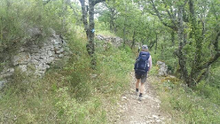
Into the Mistral 
We briefly had the Mistral as a tailwind
We found shelter from the wind in Cavaillon, where we had a lengthy lunch stop.

Lunch in Cavaillon 
Cavaillon has a long and interesting history, and we enjoyed wandering around its old streets.

The old town of Cavaillon 
Roman arch from the first century
Two shadowy figures (or is that shady characters) reading about the history of Cavaillon 
There is a hill at Cavaillon, the Colline Saint-Jacques, so we climbed it.

Cavaillon from the Colline Saint-Jacques 
Once we had admired the view, we descended back down through Cavaillon, crossed a bridge over the Durance (with the Mistral blowing us sideways) and found our accommodation for the night.

Going back down to Cavaillon 

Day:  64
Distance: 19.77 km
Walking time:  4hrs 12mins
Elevation gain:  530 metres
Cumulative distance:  1597.92 km


DAY 63 - APT TO COUSTELLET

We spent today exploring some of the countryside described in Peter Mayle's Provence books. An early awakening (a market was establishing itself under our window) was followed by breakfast overlooking the old town of Apt. 

Breakfast on the terrace
We quickly left the town and followed our GR towards the Pont Julien. For a while the GR uses a cycle path, which tracks a disused railway line between Apt and Cavaillon. 

The GR653D followed the cycle path for a while
We stopped at the Pont Julien to eat our morning tarts as we admired the bridge. We were not alone. Unlike the other Roman bridges we have visited recently, this one has a car park and is clearly visible from the main road. There were other tourists cycling over the bridge, walking around it, and posing for photographs in front of it.

The Pont Julien - our fourth Roman bridge in four days
From the Pont Julien we left the GR653D and took another long-distance path, the GR911, up to the hillside village of Bonnieux. It was a very scenic walk.

Striding out along the GR911
The path took us past cherry orchards 
We had good views of Bonnieux as we approached it 
After a wander through Bonnieux, we took to the streets for the short walk to the neighbouring hillside village of Lacoste. As in Bonnieux, there were many people exploring the historic old streets. After a pleasant lunch stop by the church we joined the other tourists in wandering around the village. 

Lunch spot at Lacoste
Tourists can admire the views of Bonnieux on a neighbouring hillside as they wander the streets of Lacoste
From Lacoste it was another shortish walk to Ménerbes, another historic hillside village. This one features paid parking, paid public toilets, and lots of tourists. It is classified as a Most Beautiful Village, and featured in Peter Mayle's A Year in Provence. We walked through the streets for a bit, then paused for some refreshments at a terrace café. 

Ménerbes - enjoying a day in Provence
Terrace café in Ménerbes - healthy fruit (raspberry) and nut (pistachio) flavours in the ice cream
It started to rain as we left Ménerbes for the short walk down to the Calavon valley, where the GR653D ran parallel to the cycle path and the main road for the final few kilometres into Coustellet. 

Day:  63
Distance: 37.72 km
Walking time:  7hrs 16mins
Elevation gain:  620 metres
Cumulative distance:  1578.16 km


Friday, 17 June 2016

DAY 62 - REILLANNE TO APT

We had fine weather and lovely scenery for today's long walk through Provence. 

A lovely old path to start this morning's walk 
After an hour and a half of easy walking, we came to the ruins of the medieval priory of Carluc. We spent some time wandering around the site.

Storyboard at Carluc Priory - another attempt at shadow photography 
Carluc Priory
Carluc Priory
Another few kilometres brought us to a Roman bridge on the way into Céreste. 

Roman bridge near Céreste 
Céreste was to be the last village of any real size on today's walk, so we bought supplies for lunch and afternoon tea, and sat down at a café for a coffee stop.

Coffee stop, Céreste 
The path after Céreste took us towards the Luberon mountains, past lavender fields and vineyards,  and through a few small hamlets.

Lavender fields beneath the Luberon 
There were no formal picnic facilities on the way (benches, picnic tables), but we found a nice shady spot by the side of the path to sit down and have our lunch.

Lunch stop by the GR653D on the way to Apt 
After lunch we were treated to some delicious cherries from a path-side tree.

No tarts today, but we kept up our intake of healthy fruit thanks to this conveniently located cherry tree 
The GR joined a cycleway for several kilometres of easy walking on the approach to Apt. 

The GR goes along the cycle path for several kilometres 
While the cycle way continued on into Apt, we took a detour up to the touristy village of Saignon. We climbed to the top of the Rocher de Bellevue for a 360 degree view of the region, including the town of Apt down below.

Haven't had a selfie for a while. This one is looking down on the town of Apt from the Rocher de Bellevue at Saignon. 
The Rocher de Bellevue at Saignon.  We had climbed up to the top of it for the previous photo. 
After a rest/afternoon tea stop in Saignon, we descended to Apt, our accommodation stop for the night.

Descending towards Apt from Saignon on the GR653D 

Day:  62
Distance: 34.47 km
Walking time:  7hrs 07mins
Elevation gain:  704 metres
Cumulative distance:  1540.44 km


Thursday, 16 June 2016

DAY 61 - FORCALQUIER TO REILLANNE

The weather forecast today wasn't promising. We were expecting to be out in the rain all day. As it turned out, we stayed dry until lunchtime.

The fortifications at Mane 
We joined the GR653D for an off-road entry into Mane, where we climbed up to the hilltop fortifications and wandered the streets of the old town. 

Old town of Mane
We rejoined the GR to head out of Mane, and stayed with it for the rest of the day. There was a real highlight a few kilometres out of Mane when the path crossed an old Roman bridge. 

Roman bridge outside Mane
Australian walker reflecting on the Roman bridge outside Mane
The path took us through rural scenery of fields and forests, like many other GRs we have followed on this trip. The landscape is quite different though - the fields are planted with sunflowers, asparagus, lavender and melons as well as wheat, there are olive groves and fruiting cherry trees in abundance, and the woods have a rugged look to them.

 Striding out along the GR653D 
Through the woods 
After a few hours we arrived in Saint-Michel-l'Observatoire. It started to rain as we entered the village, and we were glad to find a restaurant open. It was offering an enticing and reasonably priced three-course lunch menu.

Approaching our lunch stop at Saint-Michel-l'Observatoire 
There was steady rain during the couple of hours we took to have lunch, but it had eased to light drizzle by the time we resumed our walk.

A very pleasant walk, even in the rain 
We followed the GR on a roundabout route as the rain increased and there were threatening rumbles of thunder in the hills. We crossed an old Roman ford, but didn't linger. We continued on through Lincel, another attractive hillside village. By this time the thunder had stopped and the rain had eased again. We were able to enjoy the final few kilometres up to another hillside village, Reillanne, where we are staying tonight. 

Approaching Reillanne in the rain on the GR653D 

Day:  61
Distance: 23.78 km
Walking time:  5hrs 13mins
Elevation gain:  577 metres
Cumulative distance:  1505.97 km

DAY 60 - MONTFORT TO FORCALQUIER

We left Montfort this morning under the view of the Penitents, stopped to buy supplies in Peyruis, and joined the GR653D for the climb to Ganagobie.

Little white snails that one could easily mistake for flowers - except for the crunching sound they make when one accidentally treads on them
Climbing towards Ganagobie on the GR653D 
Apart from the monastery which is its main tourist attraction, the plateau also hosts the remnants of an ancient village and a network of walking paths.

The Ganagobie plateau 
Turtle cairn on the Ganagobie plateau 
The views opened up to the north as we began the descent. We could see a village on the top of the next hill. We just knew the GR would be going up to it.

Descending from the plateau
Lavender field on the way down
Before we started the next climb, we sat down by a 2nd century Roman bridge for our morning tea break. 

2nd century Roman bridge 
Once refreshed, we began the climb up to Lurs. We didn't take the GR, as it took a roundabout route which would have added an hour to our day's walk. Instead we followed the more direct Via Domitia, the old Roman road which is now also a walking path.

The Via Domitia - straight line to Lurs
Terraced olive grove near Lurs
We wandered around the historic streets for a while, soaking in the atmosphere before heading on.

Lurs
Théâtre,  Lurs
Lurs
Signs for our GR were placed throughout the village 
We found a small path to take us out of Lurs, and joined up with the GR653D a couple of kilometres later for the walk to Forcalquier. 

The path out of Lurs
Forcalquier is also an interesting, historic, hilltop town. We wandered around the old streets, then climbed up to the citadel.

Forcalquier 
This interesting spiral staircase led to the citadel at Forcalquier 
Up to the Citadel at Forcalquier 
View to the places we'd walked through today, from the Citadel at Forcalquier 
We then walked back through the town and found our way out to tonight's chambre d'hôte. 
Through the old streets of Forcalquier 

Day:  60
Distance: 34.28 km
Walking time:  7hrs 28mins
Elevation gain:  985 metres
Cumulative distance:  1482.19 km