Sunday, 27 March 2016

Preparation - 3. Maps

Having decided on our basic route, and done a lot of background reading, we started thinking about what material to take with us to help with directions on our walk.

We have decided to take hard copies of the IGN (Institut National Géographique) 1:100000 scale maps of the areas we will be going to.  These maps show the long-distance footpaths as well as topography and places of historical and geographical interest.

IGN  1:100 000 maps

We will also be taking a few Topoguides (guidebooks with detailed maps, turn-by-turn directions and route highlights) for a few of the more popular sections of the trip.

The Topoguides we will be taking
Although we are taking some printed material, we are not averse to using technology to help us find our way.  I made extensive use of Google Maps and the IGN maps on the French Géoportail site when planning our route, and we intend to use offline Google maps, and saved screenshots of other useful sites, when we are on the road (or footpath, or canal towpath).

Screenshot of a Géoportail map, for use on the road
Our smartphones will  also have many other uses: we will be using them to record the distance we travel (with the Samsung S Health app), keep track of our accommodation (much of it booked through Booking.com and available to manage on the Booking.com app; also listed on a spreadsheet downloaded on both our phones), to browse the net and check our emails when we have WiFi access, to keep in touch with our family with Skype (which we successfully trialled late last week with our wonderful younger daughter in Canberra, who asked for a mention in our next post - ie now), to play the occasional game of Scrabble, and even to make and receive phone calls. And to write this blog.


Using the phone to write the blog 

Monday, 14 March 2016

Preparation - 2. Background Reading


Part of the enjoyment in preparing for any holiday comes in the background reading. For our upcoming holiday (walking from coast to coast in France), we have been reading books about walking and books about France.

We have derived great pleasure over the years from classic accounts of long-distance walks, including Hilaire Belloc's The Path to Rome, John Hillaby's Journey Through Europe, and Patrick Leigh Fermor's A Time of Gifts and Between the Woods and the Water.
A Time of Gifts - much more than just the story of a long walk

Rebecca Solnit's Wanderlust: A History of Walking demonstrates that if those of us planning a long walk are crazy, we are following a long tradition of crazy people.

Wanderlust :a History of Walking 

We have also been reading online, and have been particularly inspired by the website of an Australian couple who spend a few weeks every year doing long-distance walks in France (www.walkinginfrance.info). In addition to diaries and maps of their walks, they offer lots of practical information for those planning similar escapades. 

Once we had determined that our holiday would be spent walking in France, we started reading more about the country, with an eye on the places we may be going and the things we might be doing.

Some holiday-specific reading

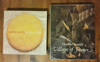
Our reading over the past few months has included French novels, history  books and travel books, as we gear up for our forthcoming adventure.


More background reading 


Sunday, 6 March 2016

Preparation: 1. Physical

1650 kilometres sounds like an awfully long way to walk. Are we crazy?

Yes.  Probably.  But we're going to give it a go anyway. 

Will our bodies hold up? We're not sure, but we hope so.  We're not as young as we used to be, so we've had to work on our fitness levels.  We have tried to build up with a combination of walking, cycling and a bit of jogging.


For some time we have been going on a weekly 20 kilometre bike ride, with a longer ride (about 50km) every couple of months.  We are fortunate to live in an area with lots of hills, so each ride is a good workout.

Of course, our physical preparation includes a lot of walking.  We used to go for an occasional stroll in the afternoons, but once we began preparing for this holiday we made it a regular habit.  We started walking 3km every weekday after work, and have increased the distance as our departure date gets closer.  With 5 weeks to go we are walking 5km every afternoon, and intend to increase this to 6km shortly.

By the Byron Bay lighthouse café 
We also go for a weekly 7km return walk up to the lighthouse at Byron Bay.  It is a lovely walk, with a lot of variety in the scenery, plenty of native wildlife, and an excellent café up the top.  We plan to
frequent the cafés when we are in France,  so we are including a weekly coffee (or chai, or mango and macadamia ice cream) as part of our training regime.

The lighthouse is also a good spot for people watching and admiring the scenery, two other activities we plan on enjoying when we are on our holiday.

Byron Bay lighthouse walk 

In addition to these regular activities, we have been going on longer or more arduous walks when time has permitted. For example, last week we walked up Mount Warning, fully laden, with some friends who are planning their own long-distance walk later this year.

Lookout, Mount Warning


Friday, 4 March 2016

The Plan


THE  PLAN

We started planning this holiday about a year ago.  At the beginning we had no fixed idea of where we would be going, but we did have some basic preferences.  We were keen to travel slowly, to eat and drink local produce in the regions we were going through, to spend some time in France, and to do some walking in the mountains.  After many revisions, we have now decided on the route we plan to take.

We are intending to cross France from north to south, starting in mid-April in Dieppe on the English Channel, and ending at the end of June in Saintes Maries-de-la-Mer on the Mediterranean coast.  We aim to do the trip on foot, using a combination of long-distance walking paths (Grandes Randonnées), canal towpaths, and normal roads.  

Our planning map - the proposed route is marked with a thick pencil
Our route takes us through 21 of the 96 Departments, and 6 of the 13 regions in metropolitan France.  We will be travelling along some of the principal rivers of the country (the Seine, the Loire and the Rhône), through villages, towns and a couple of cities, through pastoral countryside and long-established vineyards, up into the Alps and down through Provence to the Mediterranean coast.

We currently estimate the total distance of our walk as about 1,650 kilometres, although we may end up walking less (in case of injury, illness or particularly inclement weather) or more (we have read lots of accounts of people having difficulty locating the sign markings on the Grandes Randonnées and ending up walking further than they had anticipated, and we expect this to also happen to us).